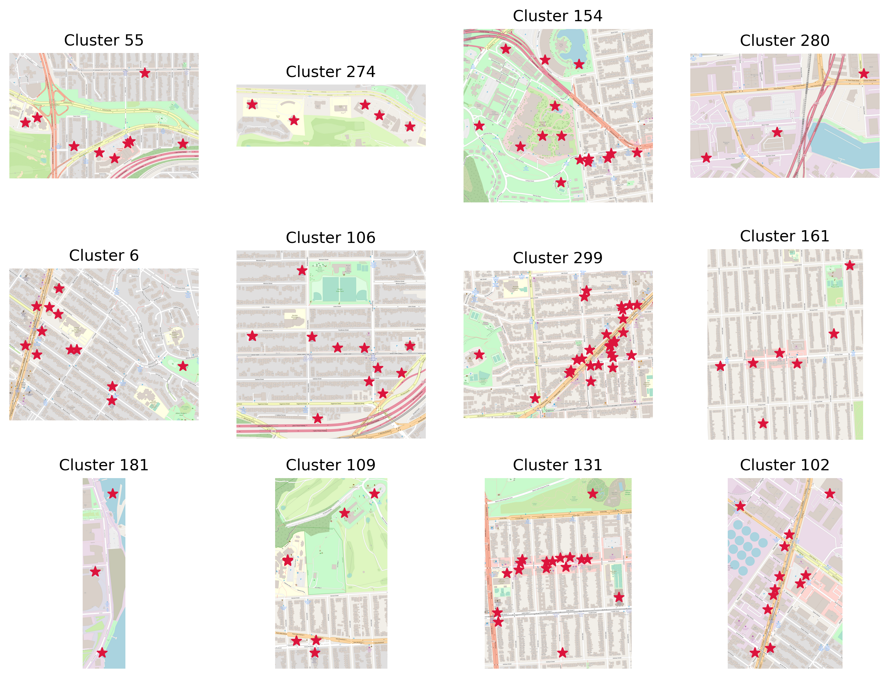
Clusters of Interest
Recommender System that suggests city clusters you might like based on your previous preference. Based on OSM San Francisco data.
Data Scientist / Data Engineer. Geospatial Analyst. Cartographer with a passion for data visualization, complex projects, and workflows optimization.
You can find my resume here.

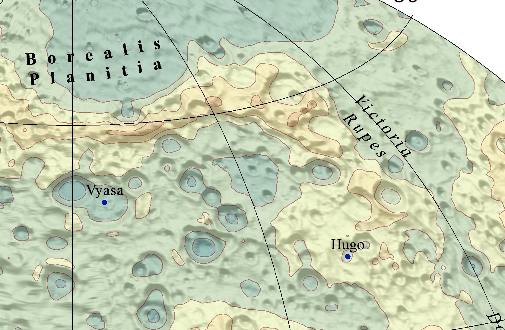
I have more than 7 years of experience working with geospatial data, having started my career making maps of the Moon and planets. My skills in getting relevant data and delivering it in a fascintating way helped numerous scientific projects. My most significant solo projects were Mercury Elevation Map and Spatial Analysis to Design the Lunar Rover's route.
My geo data career also includes such exciting chapters as setting up GIS and drone operations in a construction tech startup, working for Apple Maps and Google Maps, and managing a City of Santa Clara GIS database.
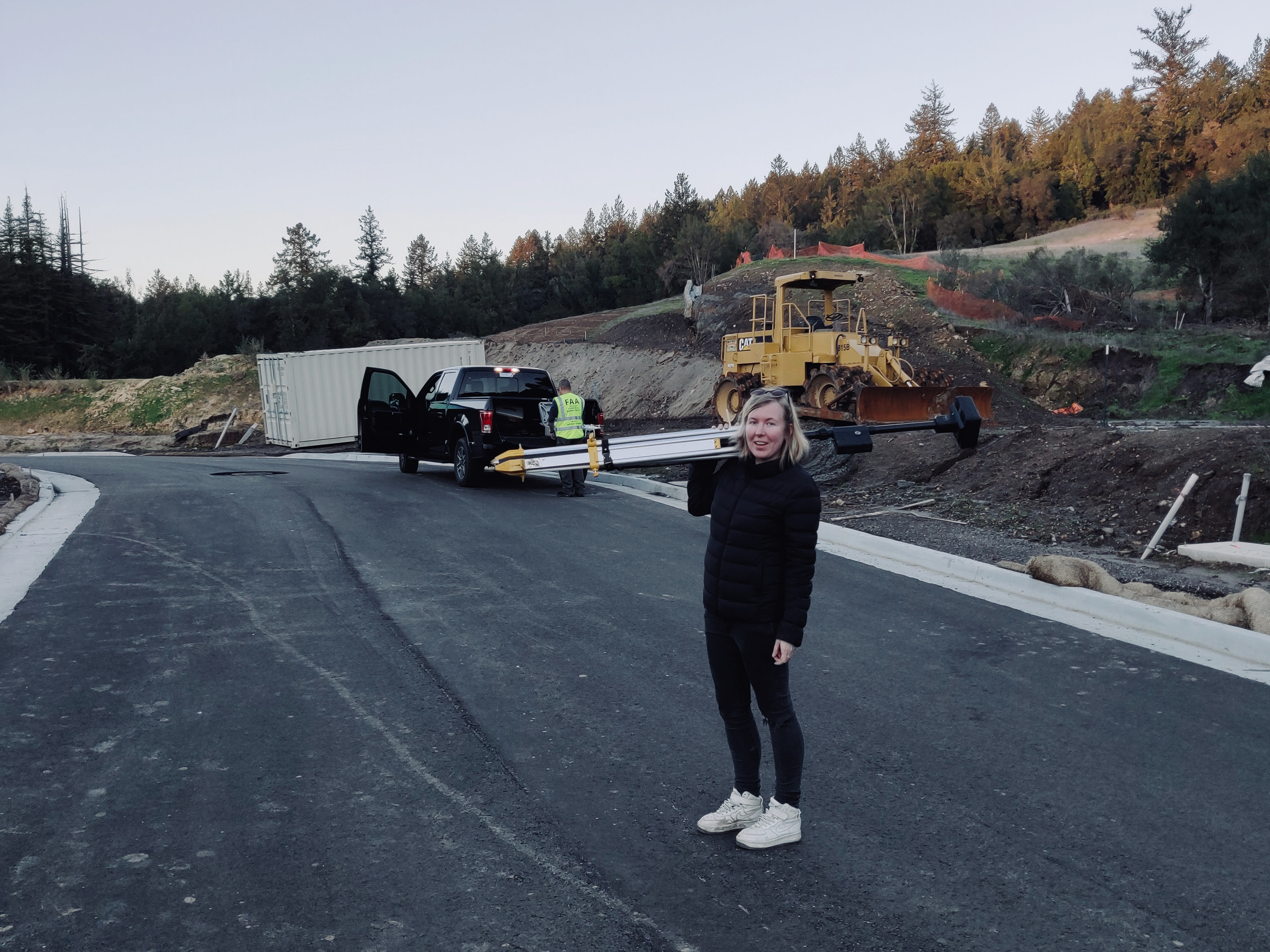
I've spent most of my professional life in the construction tech startup TraceAir. I started as a GIS data specialist and became a GIS and Drone operations manager. I've played a key role in setting up stable GIS workflows allowing TraceAir to deliver drone data overnight. Besides that, I worked as a Technical customer success, reduced drone operations cost by 50%, and experimented with photogrammetry workflows and new drone models, which ended up in production workflows.
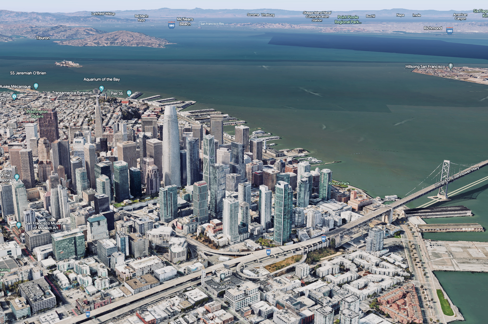
If you hover around any major city on Google Earth, you'll see the results of my work! Initially, I was supervising aerial imagery quality throughout the processing pipeline. Eventually, I started working with Software Engineers on tools improvement and delivering daily operations performance metrics for another team. The dashboards I maintain are used by several dozens of people daily.
At some point in my professional journey, I've realized that the most enjoyable part of any work I ever had is digging into data like a detective, looking for insights, and bringing those up in decision-making processes. To make that dream come true, I've completed a full-time immersive Data Science bootcamp with General Assembly, which consisted of more than 500 hours of lessons and independent work, providing a solid foundation in Data Science with real-world applications. I'm looking for an opportunity in a growth-oriented environment to apply my new skills, ideally combined with my geo data experience, so that I can bring even more value aboard.
Recommender System that suggests city clusters you might like based on your previous preference. Based on OSM San Francisco data.
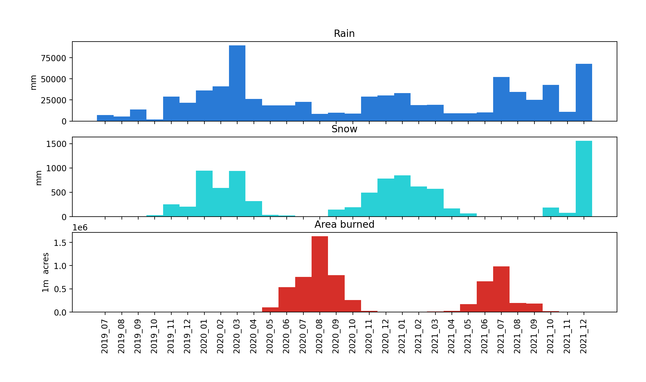
How accurately can we predict a given wildfire's acreage based on current and historical meteorological data combined with land cover data?

Fun one-day solo hackathon on image recognition and convolutional neural networks.
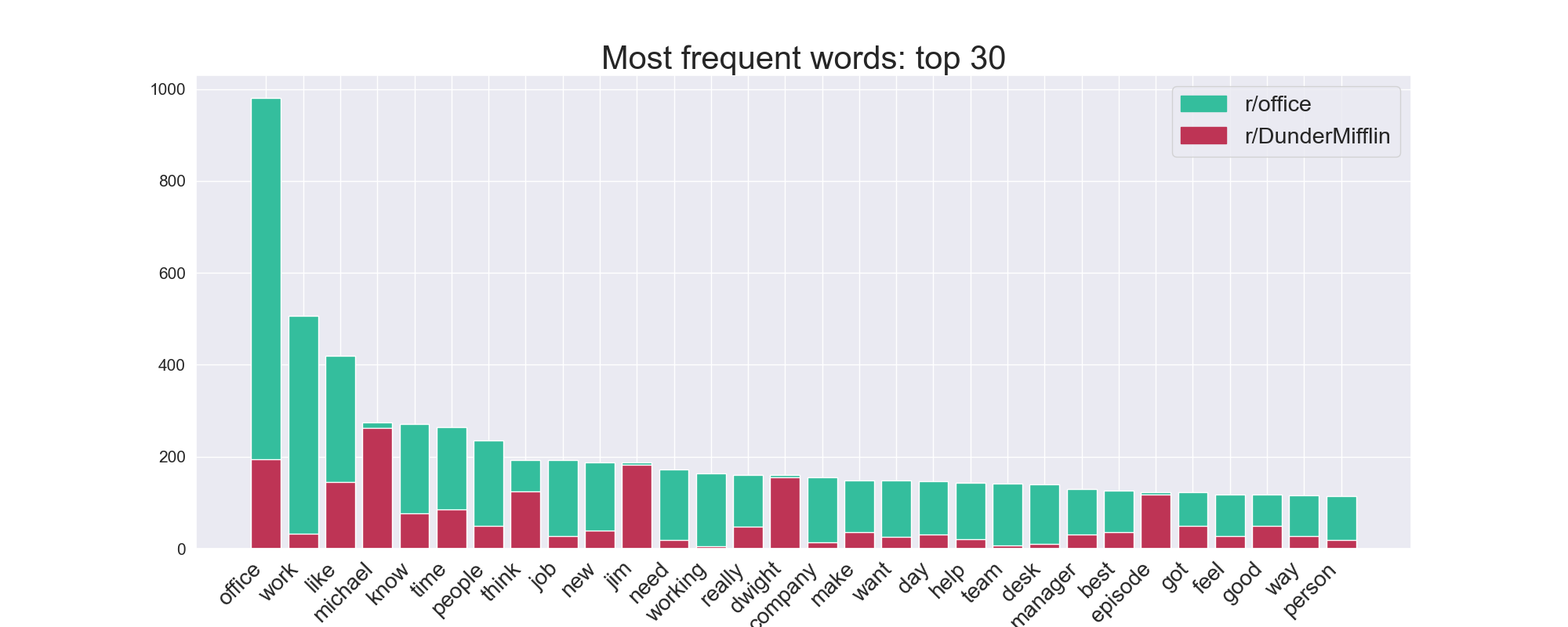
Predicting if a given post belongs to the r/DunderMifflin subreddit
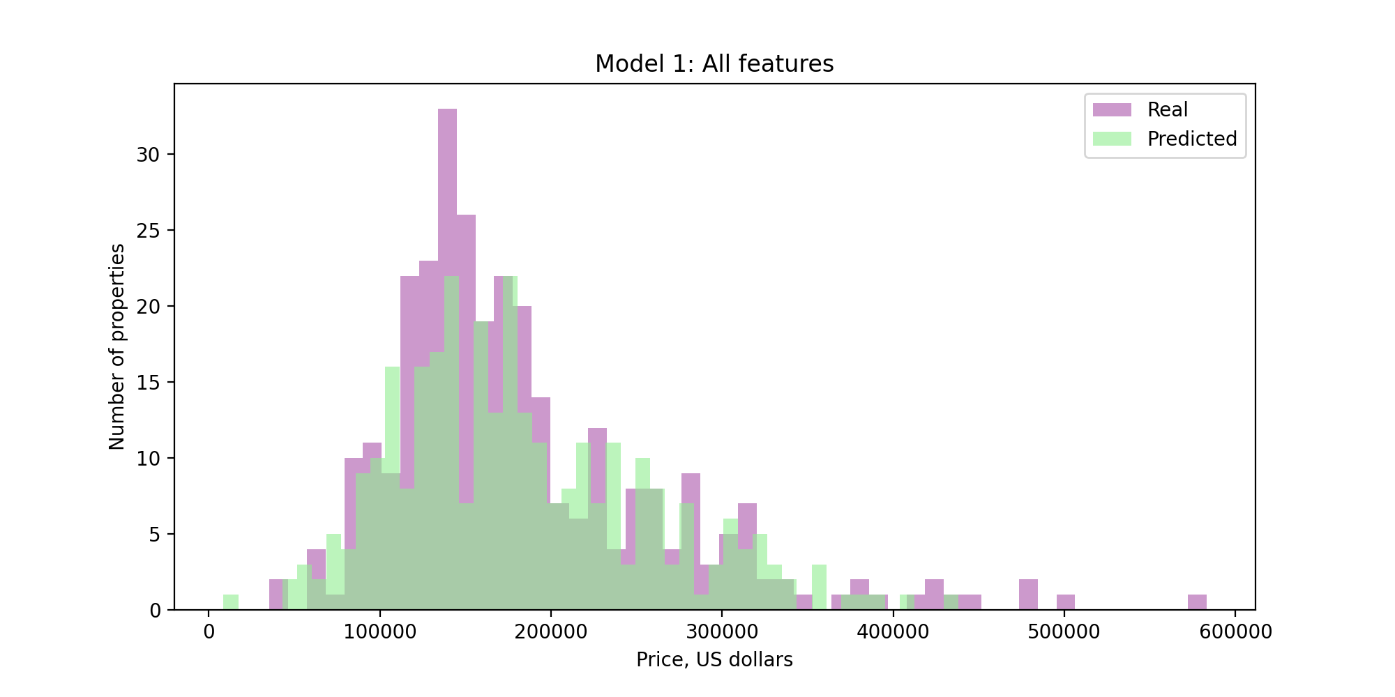
Based on a zillow data in Ames, Iowa
matplotlib, pandas, seaborn, sklearn, tensorflow, nltk, geopandas, folium, tilemapbase, datashader, regex
Regression, Classification, Natural Language Processing, Neural Networks, Image Recognition
SQL, Web Scraping, Data Visualization, Machine Learning, Troubleshooting, Git, GCP, GDAL
ArcGIS, QGIS, Google Earth Engine, AutoCAD, Remote Sensing, Drones, GPS Survey, LIDAR, Aerial and Satellite imagery
Project Management, Product Management, Training, Contractors coordination, Collaboration with cross-functional teams, Technical Customer Success
Research, Workflows Setup and Optimization, Processes Scaling